Waterway management
Upgrade of the National Waterway Asset Management Systems (WAMS) & the Transnational Waterway Monitoring System (WAMOS 2.0)
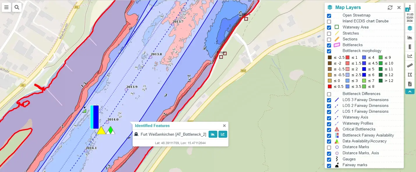
Efficient and safe navigation along the Danube relies on robust information gathering and processing. The national Waterway Asset Management Systems (WAMS) and the transnational WAterway MOnitoring System (WAMOS) are the key information hubs for consolidating data and information concerning Good Navigations Status (GNS) along the Danube.
WAMS
Functioning as the backbone for national waterway management the national WAMS collect data from various sources. Under FAIRway Danube II, participating countries upgrade their national systems. This enhancement integrates data from fixed and mobile sensors, as well as external sources, crucial for critical decision-making on national level. As a further step towards harmonised data along the Danube the newly national data will also be feed into the transnational WAterway MOnitoring System (WAMOS).
WAMOS
The transnational WAMOS collects hydrological and hydrographical data from the riparian Danube Waterway Administrations in one system. It offers a harmonized display and quality of the data along the entire Danube from the border of Germany and Austria to the Black Sea. At the moment WAMOS provides data on river morphology in bottlenecks, fairway availability statistics, water-levels and hydrological conditions.
The upgrade to WAMOS 2.0 in FAIRway Danube II represents a step forward in transnational waterway management for enhanced navigational safety and efficiency.
The upgrade of the WAMS’s and the enhancement of WAMOS 2.0 will improve the information access and planning reliability for all users on the Danube.
All these initiatives actively contribute to attractiveness of inland shipping as a climate-friendly mode of transport.