Side arm re-connection ‘Haslau Regelsbrunn’
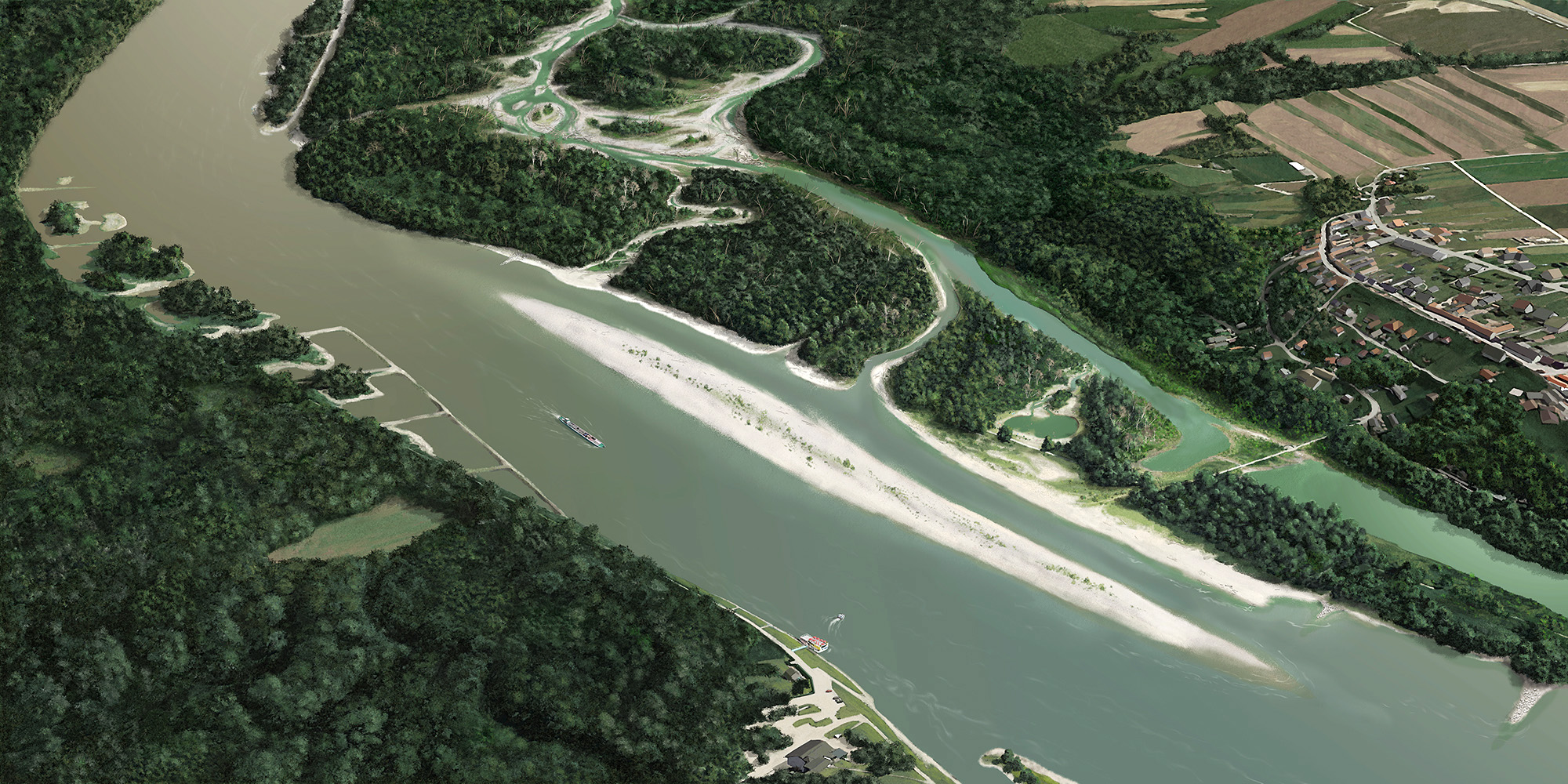
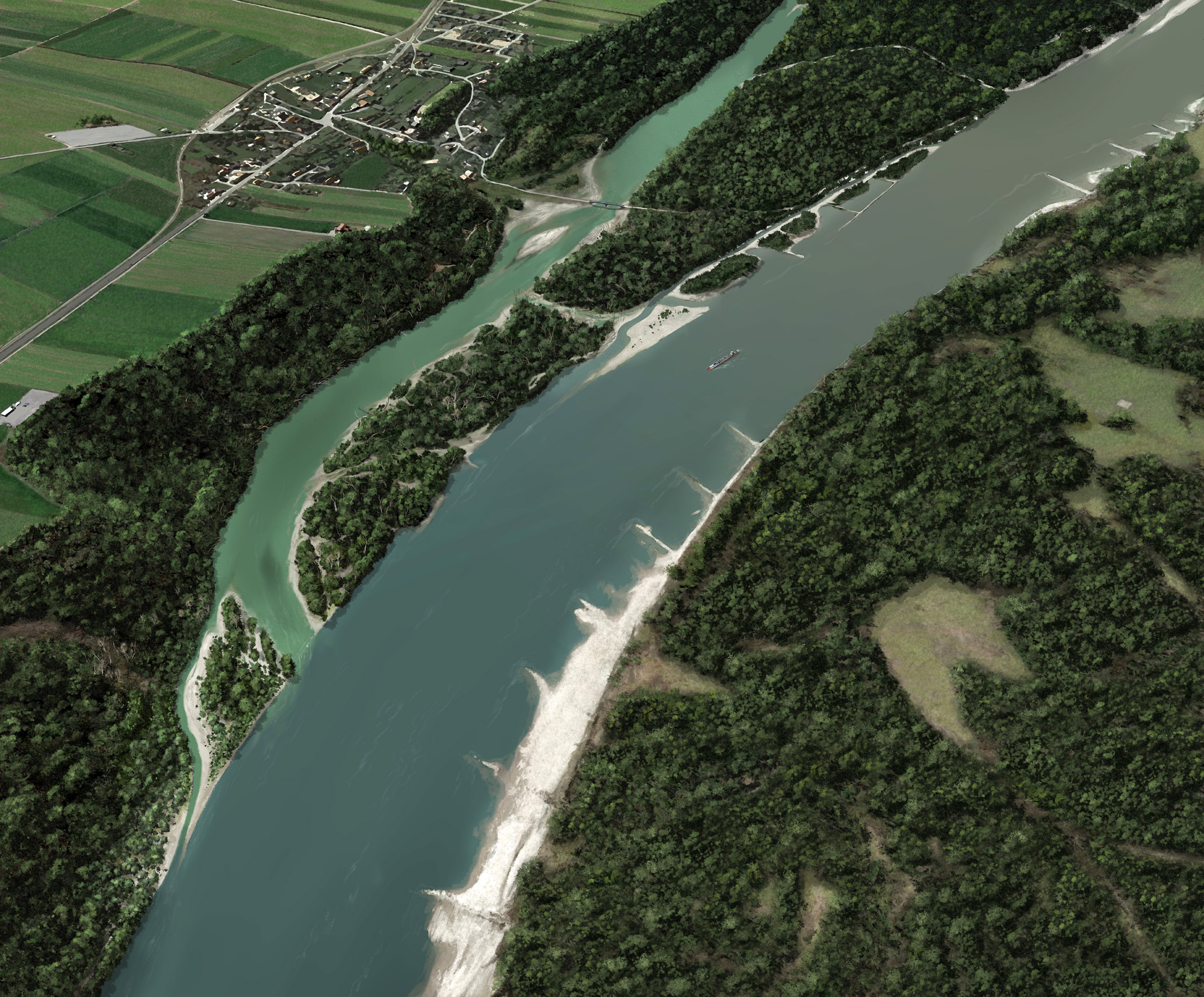
The sidearm system Haslau-Regelsbrunn (in the area of river km 1902-1895, right bank) in Lower Austria represents one of the largest tributaries of the Austrian Danube. Despite the existing river regulations, small-scale sedimentation and erosion processes can still be observed in this area, which are important for the plants and animals which are typical for this ecosystem. This is due to the low altitude of the riparian forest, but also because of a first renaturation project conducted in the 1990s. The main part of the floodplains was “ransomed” by the WWF in 1989 with the help of donations and has been managed by the Donau-Auen National Park since 1996. Reestablishing the connection of the side arm systems to the Danube is necessary to prevent a dry fall of the waterbody which has already significantly dropped from 200 days in 1998 to 140 days today.

Description of planned measures
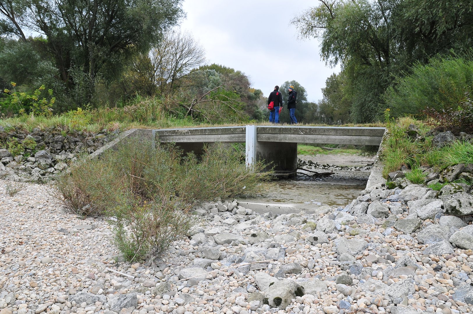
According to the planning phase, a main inflow opening shall be created slightly downstream of the Haslau-traverse, through which water can flow into the tributaries almost all year. From there riverbank renaturation will be conducted, extending until just before the right bend of the Danube, by which a natural river bank can develop.The existing concrete casement passages will be removed. The remnants of the ‘Mitterhaufen’ traverse will be removed and the ‘Regelsbrunner’ traverse will be replaced by far more generous openings so that water can flow through unrestricted. A newly designed outflow area ensures that water and sediments can flow back into the Danube. An all year long possibility for fishes to pass, shall be ensured in the inflow and outflow area. A big riverbank restauration area along the main riverbank after the right bend of the Danube shall strengthen the island character of the existing gravel structures. The future network of paths was designed in consultation with the landowners, the municipalities and on the basis of feedback from the local residents.
In total, the measures will result in several tributaries where water can flow through all year long with a length of about 10 km and a 3 km long natural shore along the main stream with some islands. With the help of these measures, the siltation of the side arm system can be counteracted in this way.
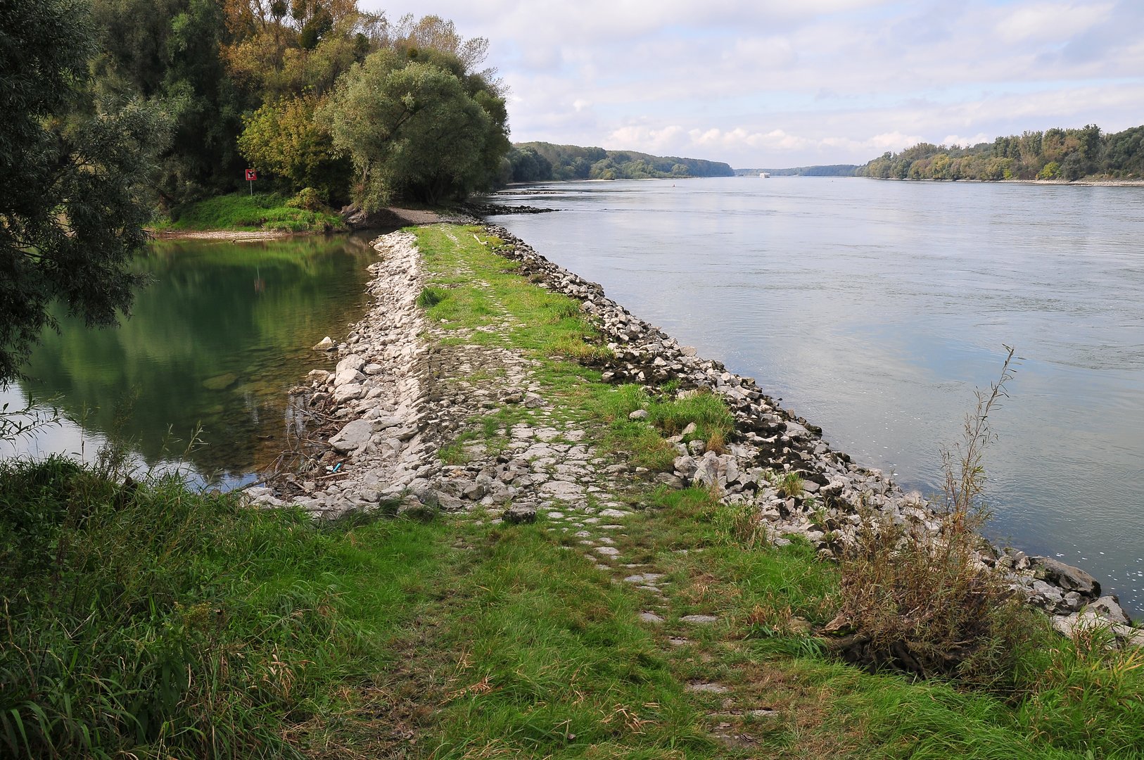
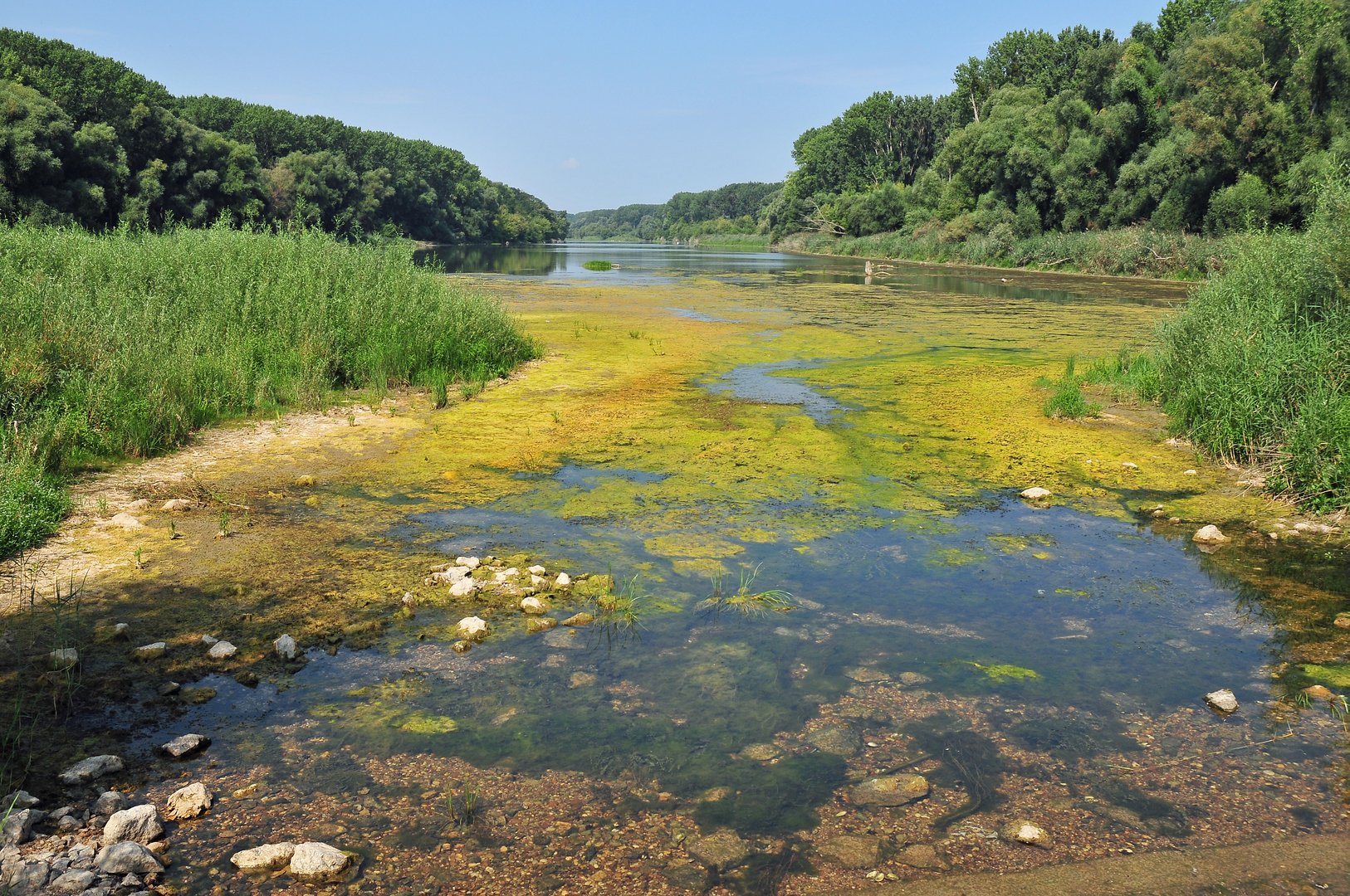
The following pictures show the current situation at the sidearm system Haslau-Regelsbrunn.
On-going activities & Outlook
The measures for the reviatlisation of the Danube floodplains in the Haslau-Regelsbrunn section were determined in the course of the detailed planning phase. Exploration work to examine the existing structures and the subsoil were completed. A concept for the future network of paths was drafted with the landowners, the municipalities and on the basis of feedback from the local residents. Following extensive geotechnical investigations, the necessary regulatory procedures have been successfully completed. All official permits for the implementation of the planned project measures have therefore been obtained. Preparatory work has been underway since the beginning of the year. Construction is scheduled to begin in fall 2026.
Close to Wildungsmauer at the location of the future estuary of the sidearm back in to the Danube, gravel which was piled up in previous years of waterway dredging was returned to the Danube in 2019. The material was used as part of viadonau’s bedload management and to reduce the river bed erosion.
Back to 'Overview of aims & measures'
Shortlink: lifelines-danube.eu
#LifelinesDanube on facebook | twitter | instagram | linkedin
DEUTSCHE WEBSITE | STRÁNKA V SLOVENČINE | ENGLISH WEBSITE
Last change:
22. 06. 2026