The Danube can be used by international shipping from Sulina located at the end of the middle delta arm at the Black Sea in Romania (river km 0), right through to the end of the German Danube near Kelheim (river km 2,414.72).
The Belgrade Convention of 18th August 1848 applies to the main route between Kelheim and Sulina, and guarantees freedom of navigation on the Danube for merchant ships flying the flags of the riparian states.
In accordance with the Danube Commission, international shipping is free to navigate the Danube waterways which, according to physical-geographical characteristics, are divided into three main sections. These nautical characteristics are shown in the table below:
Nautical characteristics
| Navigable sections of the Danube | Upper Danube (Kelheim - Gönyü) | Middle Danube (Gönyü - Turnu-Severin) | Lower Danube (Turnu-Severin - Sulina) |
| Section length | 624 km | 860 km | 931 km |
| River km | 2,414.72 to 1,791.33 | 1,791.33 to 931.00 | from 931.00 to 0.00 |
Avg. Gradient per km | around 37 cm | around 8 cm | around 4 cm |
Height of drop | around 232 m | around 68 m | around 39 m |
Speed of ships upstream | 9 - 13 km/h | 9 - 13 km/h | 11 - 15 km/h |
Speed of ships downstream | 16 - 18 km/h | 18 - 20 km/h | 18 - 20 km/h |
There are characteristical differences in the distribution of water flow between the three sections of the Danube over the course of the year. These are dependent not only on geological and climatic conditions, but also on the river’s tributaries. The highest water levels generally occur from May to August in the region of the Upper Danube, with the lowest water occurring between October and March. The low-water periods in the Middle and Lower Danube are the months of August to October, with high waters occurring between the months of April and May.
Water flow in Vienna (observation period from 1981 to 2010):
Danube (m3/s) | Danube Canal(m3/s) | Total (m3/s) | |
|---|---|---|---|
| LNWL | 970 | 120 | |
| MWL | 1,910 | 160 | |
| HNWL | 5,010 | 200 | |
100 - year flood (Danube and New Danube) | - | - | 10,400 |
Source: viadonau KWD 2010
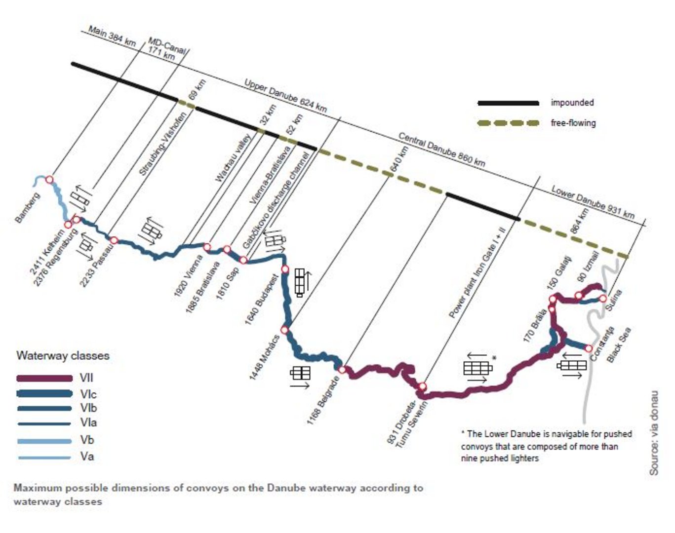
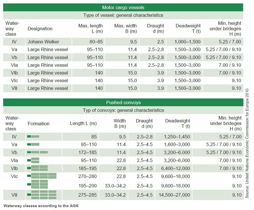
The different waterway classes of the individual sections of the Danube and the maximum dimensions of deployed vessel units (convoys) are shown in the following illustration. This also shows different possible configurations of convoys for upstream and downstream journeys in both impounded and free-flowing sections of the Danube.
