In the course of the relaunch of the viadonau website at the beginning of 2015, the DoRIS website (www.doris.bmvit.gv.at) was also revised and adjusted to the new design. The visualisation of the regularly updated shallow section information was adapted and supplemented by the additional information on the depth of the deep fairway channel, which is contained in the maps that are available for download. The current water levels and the actual information on the status of the Austrian locks are now also available in the new design. Furthermore, the graphical display of the low water forecast was extended from three to five days for the gauges Kienstock and Wildungsmauer.
In the course of the migration process, the information on the current vertical bridge clearance was integrated into the DoRIS website as well. Together with the Supreme Shipping Authority 8 bridges were identified on the Austrian Danube sector, that might pose a problem for navigation in terms of bridge clearance. Those bridges have a clearance lower than 8m at highest navigable water level (HNWL = water level reached of exceeded at a specific Danube stretch on an average of 1% of days in a year (3.65 days) over a reference period of several decades). One of these bridges, the railway bridge in Linz, was demolished in 2016.
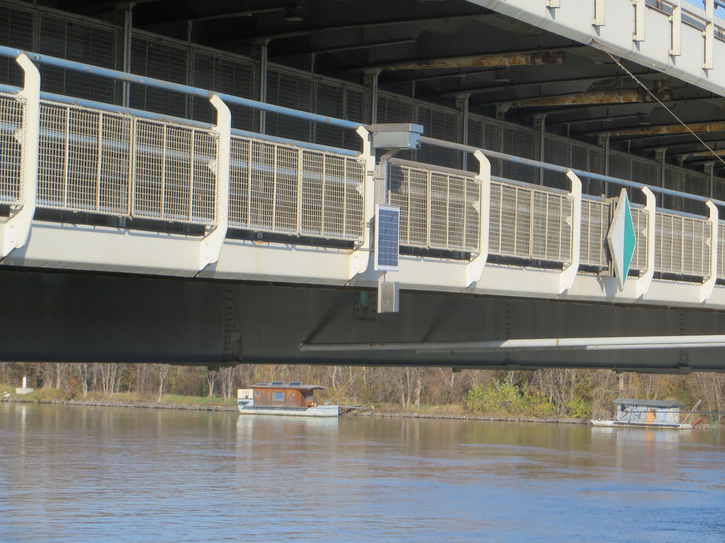
The current vertical bridge clearance is constantly recalculated using data from nearby hydrological gauging stations or radar gauges. In this process, radar beams are sent to and reflected by the water surface. The reflection time determines the current bridge clearance.
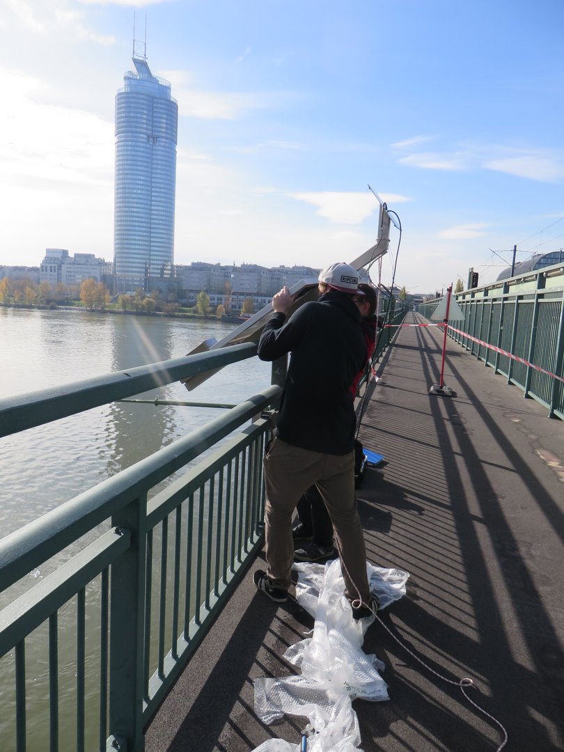
The gauges are mounted on the respective bridges and equipped with solar panels, in order to ensure the energy-efficient and low-maintenance operation of the gauges. viadonau´s team "Hydrology" is responsible for the installation and maintenance of these measuring devices and therefore significantly involved in the user information provision.
News and activity status
In November 2017, the two remaining relevant Danube bridges (the Praterbrücke and the Georg-Danzer-Steg in Vienna) were also equipped with appropriate devices for vertical bridge clearance measurement. Consequently, the vertical bridge clearance is now being published for all seven critical Danube bridges in Austria via the DoRIS website and the DoRIS Mobile App (available for iOS and Android).
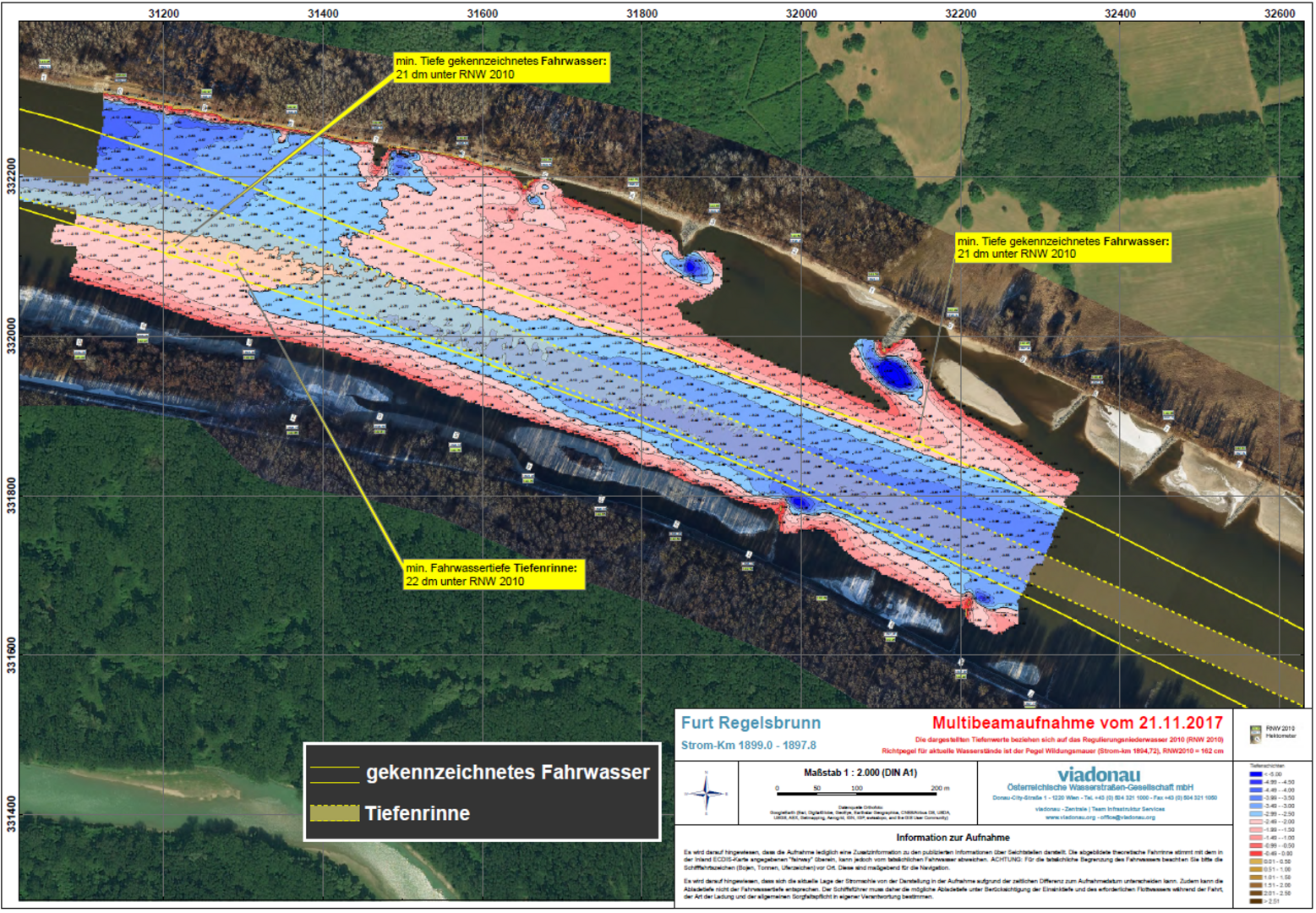
In addition to the current minimum fairway depths provided by viadonau to date in the area of relevant shallow bottlenecks in the two free flow sections of the Austrian Danube, the current minimum fairway depths in the entrance areas of the public Danube ports have also been published on the DoRIS website since February 2019. The measurements of the harbour entrance areas form the basis for the hourly and automatic recalculation of the minimum fairway depths in the right, middle and left areas of the port entrances.
With the RIS Open Service Initiative, viadonau, as a modern infrastructure operator, also complies with the concept of "Open Government Data" in the area of River Information Services. This provides for administrations to make their non-personal data publicly accessible.
A large part of the fairway information offered in DoRIS can now be accessed via predefined web interfaces and used free of charge by all interested parties. The provided interfaces and their content are described on the Open Service Portal and can be tested there without registration. Via the "Try it out" function within each service category, the respective data can be retrieved (limited in the query frequency). For the permanent use of the interfaces as well as the integration of these interfaces in third party applications (e.g. application manufacturers) it is possible to request a so-called partner key (API Key). The data is then automatically requested by the respective third-party applications.
The activity makes a substantial contribution to the implementation of measure 03. Improve and enhance fairway information of the Action Programme for the Danube 2022.